 FA+
FA+
309
Views
Views
5
Favorites
Favorites
Category
Artwork (Traditional) / Tutorials
Species Unspecified / Any
Size 1280 x 931
File Size 286.1 kB
Report this content
More from Walt46


Listed in Folders


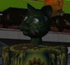
A series of maps were commissioned years ago by the Imperial & Royal Army of Faerie and by Antecor™ - owner of an Empire-wide network of ant care stations and hostelries - to depict parts of the kingdom. Some of them were left deliberately unfinished, so that Elves could find their own way and discover things for themselves.
That's their story, and they're sticking to it.
This shows the extreme southeastern corner of the Empire, from Rajjan Tor on the border with the Southlands to the port town of Mont Rose. Both are centers of Mephitist worship (as indicated by the Musked Circle symbol), and Rajjan Tor bears a fort and banner to show that an I&RA garrison is stationed there.
Based on offhand comments made by myself, eocostello and
  tegerio last night.
And yes, I suck.
That's their story, and they're sticking to it.
This shows the extreme southeastern corner of the Empire, from Rajjan Tor on the border with the Southlands to the port town of Mont Rose. Both are centers of Mephitist worship (as indicated by the Musked Circle symbol), and Rajjan Tor bears a fort and banner to show that an I&RA garrison is stationed there.
Based on offhand comments made by myself,
 eocostello and
  tegerio last night.
 And yes, I suck.
Category Artwork (Traditional) / Tutorials
Species Unspecified / Any
Size 1280 x 931px
File Size 286.1 kB
Listed in Folders

i do believe i started kindergarten about ten miles north of where your map ends north of dehorson tor. of course that was a very long time ago and i've no doubt the surrounding lands have changed greatly since. my dad, who was a speaker to vapour dragons, used to cut yule trees on the side at the right time of year, around the other side of the lake east of there.

Comments